
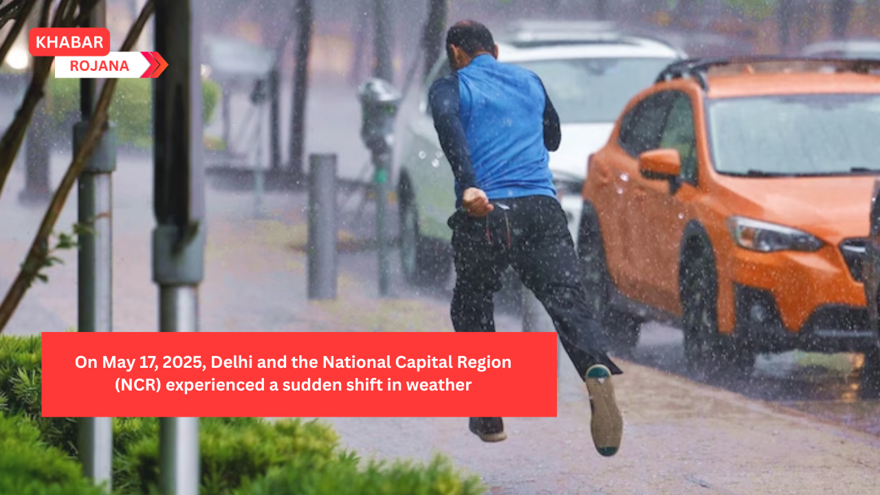
On May 17, 2025, Delhi and the National Capital Region (NCR) experienced a sudden shift in weather, bringing much-needed relief from the intense summer heat. The India Meteorological Department (IMD) had forecasted thunderstorms accompanied by rain, and the prediction materialized as strong winds, dust storms, and rainfall swept across the region.
Residents of Delhi-NCR, who had been enduring temperatures soaring above 42°C, welcomed the unexpected downpour. The rain, coupled with gusty winds, not only cooled the atmosphere but also improved air quality, which had deteriorated due to dust-laden winds from western regions
The sudden dust storms significantly reduced visibility in several areas. At the Indira Gandhi International Airport, visibility dropped from 4,500 meters to 1,200 meters within a short span, affecting flight operations . The IMD attributed these conditions to strong westerly winds carrying dust from Rajasthan and Pakistan.
The maximum temperature recorded at Safdarjung was 42.3°C, while Palam experienced a high of 43.3°C. However, the rainfall brought a slight dip in temperatures, providing temporary respite from the heatwave conditions .
In response to the volatile weather, the IMD issued a yellow alert for Delhi-NCR, warning of potential thunderstorms, dust storms, and light rain in the coming days. Residents were advised to stay indoors during severe weather and take necessary precautions .
The sudden gusts of wind caused structural damage in some areas. Notably, the roof of a Regional Rapid Transit System (RRTS) station was blown away, raising concerns about infrastructure resilience during extreme weather events .
The dust storms led to a sharp decline in air quality, with the Air Quality Index (AQI) crossing 200, categorizing it as ‘poor.’ The Commission for Air Quality Management invoked Stage 1 of the Graded Response Action Plan to mitigate pollution levels .
Different parts of Delhi-NCR received varying amounts of rainfall. Ayanagar recorded the highest at 7.2 mm, followed by Ridge with 3.2 mm, and Safdarjung with 1.4 mm .
| Location | Max Temp (°C) | Min Temp (°C) | Rainfall (mm) |
|---|---|---|---|
| Safdarjung | 42.3 | 24.3 | 1.4 |
| Palam | 43.3 | 26.4 | 0.3 |
| Lodi Road | 42.3 | 24.0 | 1.3 |
| Ridge | 43.2 | 23.5 | 3.2 |
| Ayanagar | 44.0 | 23.9 | 7.2 |
The current weather changes are attributed to an active upper air cyclonic circulation over Haryana and a trough extending from northwest Uttar Pradesh to Bangladesh. These systems are expected to cause intermittent rain and thunderstorms in the region over the next few days .
Authorities have urged residents to exercise caution during thunderstorms and dust storms. Precautions include staying indoors, avoiding shelter under trees, and disconnecting electrical appliances during lightning .
While Delhi-NCR experiences these weather fluctuations, other parts of India are also witnessing significant weather events. The IMD has forecasted heavy rainfall in southern states like Tamil Nadu, Kerala, and Karnataka over the next five days, indicating a broader shift in weather patterns across the country .
The sudden change in weather in Delhi-NCR has brought temporary relief from the scorching heat but has also highlighted the need for preparedness against extreme weather events. Residents are advised to stay updated with official weather forecasts and adhere to safety guidelines.